Speed. Accuracy. Agility.
We deliver consistent results in an inconsistent world.
We were founded in 2005 to become the nation’s premier technology staffing and IT recruiting firm. Although we’ve grown and evolved into much more than that since, information technology will always be at the heart of our business. Simply put, IT is who we are.
You need employees in your IT department who have the right skills and experience to ensure your business is efficient and secure. Our technical recruiters are equipped with the industry insight and hiring expertise you need to fill these high-value positions with confidence.

IT Recruiting Statistics
1.86
Submit to hire ratio
1.42
Interview to hire ratio
93%
Client retention rate
Information Technology Professionals We Place
- .Net Developer
- Backend Developer
- Big Data Engineer
- Business Analyst
- Business Intelligence Analyst
- Business Intelligence Developer
- Business Systems Analyst
- C++ Developer
- Chief Information Officer
- Chief Information Security Officer
- Chief Technology Officer
- Cloud Architect
- Computer Analyst
- Computer Programmer
- Computer Scientist
- Cybersecurity Analyst
- Data Analyst
- Data Architect
- Data Engineer
- Data Scientist
- Database Administrator
- Database Architect
- Database Developer
- Desktop Support Technician
- DevOps Engineer
- Enterprise Architect
- ETL Developer
- Front End Developer
- Full Stack Developer
- Help Desk Technician
- HRIS Manager
- IT Director
- IT Manager
- IT Support Technician
- Java Developer
- JavaScript Developer
- Machine Learning Engineer
- Mobile Application Developer
- Network Administrator
- Network Architect
- Network Engineer
- Network Operations Manager
- Penetration Tester
- Product Manager
- Program Analyst
- Program Manager
- Project Manager
- Python Developer
- Quality Analyst
- Salesforce Administrator
- Scrum Master
- Security Analyst
- Software Developer
- Software Development Manager
- Solution Architect
- SQL Developer
- System Administrator
- Systems Analyst
- Systems Engineer
- Technical Trainer
- Telecommunications Administrator
- UI Designer
- UX Designer
- UX Developer
- Web Developer
- WordPress Developer
Our IT Recruiting Process
When you work in IT, you’re in a sector that’s constantly evolving, and we understand that finding the right tech-savvy individuals can be a game-changer for your business. That’s why our recruiting process is designed to be as agile and effective as the technologies you work with. Here’s how we do it:
1
Candidate
sourcing
Leveraging our extensive network and the latest AI technologies, we begin with a vast pool of resumes to find candidates with the skills that match your specific IT needs. We look beyond credentials on paper to produce the best talent available.
2
Technical
qualification
Our team conducts rigorous technical assessments and interviews to ensure candidates have both the hard and soft skills required for your IT roles. From programming languages to project management, we dig deep.
3
Soft skills
screening
Emotional intelligence and teamwork are often as vital as technical expertise in IT. We conduct comprehensive evaluations to assess candidates’ adaptability, problem-solving skills, and fit with your company culture.
4
Manager
reference checks
Our final step is the professional reference process, which involves speaking with former employers to confirm the candidate’s work ethic, competency, and suitability for the role.
Our targeted IT recruiting process ensures that you get the talent that not only meets but exceeds your expectations. At the end of the day, we understand that it’s not just about filling vacancies; it’s about building a resilient, forward-thinking IT team that propels your organization into the future.
Information Technology Recruiting Services
Direct hire
Specialized recruiting for those niche IT roles or when your in-house team needs help.
Contract staffing
We source tech pros ready to dive in from day one for immediate project needs or tight deadlines.
Contract-to-hire
Our contract-to-hire options in IT staffing offer you the agility to make quick, effective hires.
Payrolling
Our services for when you know who you want to hire but need someone to handle payroll and onboarding.
Executive search
Finding your next leader with careful attention to detail, industry knowledge, and confidentiality.
Resume sourcing
Our budget-friendly option delivers well-matched IT resumes that align with your specific needs.
Past Successes in IT
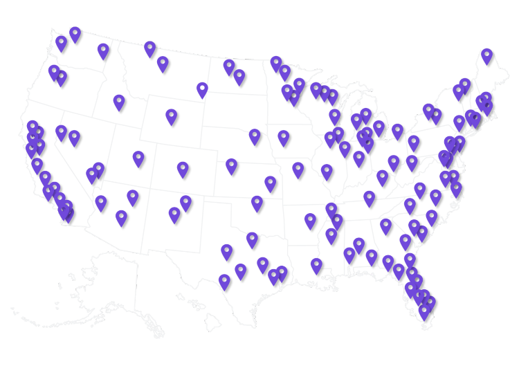
We Staff Technology Professionals Across the U.S.
We have experience placing IT professionals across 100 cities throughout the United States. This includes major cities like Denver, New York City, Orlando, Tampa, Dallas, Atlanta, Nashville, and Miami. We also staff in smaller cities like Lakeland, Huntsville, Midland, Burlington, and Charlottesville.
FAQs
What types of IT roles can you help us fill?
We specialize in staffing a wide range of IT positions, from software developers and data analysts to IT managers and cybersecurity experts. See our full list of job descriptions to learn more.
How quickly can you find a candidate for an urgent IT project?
Timing varies based on the complexity of the role, but we aim to provide qualified candidates as swiftly as possible, often within a few days for urgent needs.
Do you screen candidates for technical skills?
Yes, our recruiters are well-versed in the IT sector and use various methods to assess candidates’ technical competencies, including in-person interviews and skills testing.
Can you assist with remote IT staffing?
Yes, we can source candidates open to remote work or help you transition to a remote-friendly IT staffing model.
What’s the benefit of using contract-to-hire for IT roles?
Contract-to-hire allows you to evaluate an IT professional’s skills and fit within your organization before committing to a permanent hiring decision.
How do you ensure a candidate is a good culture fit?
Beyond technical skills, we also evaluate soft skills via in-depth interviews and past performance through manager reference checks to ensure a strong cultural fit with your organization.

I have never seen a staffing challenge stump our 4 Corner client manager. We have had 75 parallel projects within the fiscal year consisting of various skills, rates, and hurdles to overcome. While other vendors come up short, you only hear of possibilities and solutions from our CM, who is backed by an equally great team.
JM, Hospital System IT Operations Director